
Gilroy Street Directory: Address to Household
"Who lives on this street" contains two questions. Ownership follows an assessor parcel and named deed parties. Residence is time-specific and may be suggested by a directory or a person's own voter registration, but an APN alone does not prove it. A useful address workflow moves from situs to APN, map, legal description, deed, and then household evidence.
Use the same address string at each handoff. Save unit, direction, street type, spelling, rural wording, and search date. Then follow this sequence:
- Enter the Gilroy situs in the Santa Clara County Assessor search, accept the terms, and record the APN. If simple entry fails, use the structured address tab.
- Open SCCMap, zoom to the street segment, click the target parcel, and record adjoining APNs. Check air parcels when a condominium footprint may contain stacked interests.
- Use the parcel key with the Assessor counter or map and characteristics request route. Treat the web result as assessment evidence, not as a public owner-name list.
- Take the APN, legal description, and any current title name to the Clerk-Recorder's in-person Official Records Index. Find the acquisition deed, then walk grantor to prior grantee.
- Pair each ownership interval with a city permit, a voter self-check when the person is present, and the library's reverse directories or newspapers for earlier household clues.
The chain shows how a parcel moved through time, which office holds the next document, and where evidence stops. It cannot turn everyone connected with a street into a public list.
Gilroy Street Search Starts With Situs
Santa Clara's Assessor uses situs for the property address where land or building resides. It differs from the mailing address used for tax correspondence, which may point elsewhere or to a box. A matching address can support an owner-occupancy clue, but cannot prove who is at a property.
The form offers Simple Address, Advanced Address, and APN modes. It has no owner-name mode. Search a complete Gilroy address, or separate number, direction, name, type, unit, and city. APN accepts eight digits with or without dashes. Each mode has a required terms checkbox.
If an old address fails, do not invent a street history. Gilroy incorporated in 1870, and early records may use county, township, rancho, rural-route, or postal language. Use the map, plat, legal description, and GIS parcel layer. No verified renumbering or annexation ordinance was located.
Gilroy Street Directory Assessor Fields
These visible fields normalize an address before GIS or deed research. They do not promise that every field appears in a returned parcel card. APN and assessed-value output were verified, but not a full anonymous result screen, export, pagination, or owner visibility.
| Mode or field | Type | Required | Street-search use |
|---|---|---|---|
| Simple Address Search | Tab | Mode choice | One free-text property address |
| Property address | Text or autocomplete | Yes | Situs address, not mailing address |
| Street Number | Text | Yes in Advanced | Numeric address component |
| Street Direction | Dropdown | No | Printed direction when present |
| Street Name | Text | Yes in Advanced | Name without the suffix |
| Street Type | Dropdown | No | Printed suffix such as a street type |
| Unit | Text | No | Apartment or condominium unit |
| City | Dropdown | Yes in Advanced | Select Gilroy for an incorporated Gilroy situs |
| APN Number | Text | Yes in APN mode | Eight digits, dashed or undashed |
| Terms and conditions | Checkbox | Yes | Required before the search runs |
Individual web research is free. The Assessor describes the data as current-owner or closed-roll information that may be out of date, for assessment rather than transaction use. The web page suppresses the assessee name. A separate map and characteristics form accepts APN, property address, owner name, requestor contact, and return-mail, fax, or email choices. Use that form, the counter, or focused CPRA when the web result is not enough.
SCCMap for a Gilroy Street Directory
County GIS is the spatial bridge between an address and its parcel records. Open the SCCMap and County Maps Portal, choose a map, zoom to the street, and click the target polygon. Note its APN, then click adjoining polygons. Pan along both sides instead of guessing from house numbers.
| GIS control or layer | Type | What it contributes |
|---|---|---|
| Map or portal search | Text or search control | Opens a map or application |
| Layer list | Checkboxes | Parcels, air parcels, land parcels, streets, and selected planning layers |
| Zoom, pan, and parcel click | Map controls | Street browsing and polygon selection |
| Download | Dataset link | Published shapefile or open-data access |
| REST endpoint | Service link | Reproducible web GIS access where published |
GIS is not an owner directory or title survey. Parcel data update about annually, while streets update quarterly. The county warns that GIS can disagree with primary records. If a layer is missing, use the data page request form or email route. Save APNs and the map date before opening the Assessor or Recorder.
Gilroy Address Records by Street
An address record chain works best when the record set is named first. APN links property search to a map. Legal description links parcel to deed. A permit gives a dated project clue. A reverse directory can list a householder for one year. Voter data cannot be browsed as an ordinary address roster.
| Record set | Keeper | Address evidence | Access channel |
|---|---|---|---|
| Assessment roll and parcel | Santa Clara Assessor | Situs, APN, assessed value | Free web search, counter, or request form; owner suppressed online |
| Parcel and street layers | Santa Clara County GIS | Adjacent polygons, streets, air-parcel relationships | Free viewer, downloads, REST, or data request |
| Deeds, liens, and maps | Clerk-Recorder | Named parties, dates, document numbers, legal descriptions | In-person index; copies in person or by mail |
| Permits and inspections | City of Gilroy | Work at an address, dates, applicant or contractor clues | EnerGov portal or focused city records request |
| Voter registration | Registrar of Voters and SOS | One voter's status or authorized registration data | Self-check; file access only for a qualifying purpose |
| Reverse directories and newspapers | Gilroy Library and SCCLD | Listed householders, notices, addresses, and dates | At-home or in-library access, reference help |
The links are sequential. Assessor gives APN, SCCMap checks the parcel, Recorder supplies title parties, and city or library adds dated context. A deed party is not automatically an occupant. A permit applicant is not automatically the person at the address. A listed householder belongs to its directory year.
Gilroy Permit History at One Address
Gilroy's City-hosted EnerGov portal is an address-keyed route for building and property activity. Permits can date construction or alterations and may name an applicant or contractor. They help with parcel history, not a current household list.
The JavaScript permit portal's complete search filters, result fields, oldest online year, and code-enforcement visibility were not available for authoritative inspection. Use the portal for the record types it exposes, then send a narrow request through Gilroy's public-records channel when a defined existing permit or inspection record is needed. Include the address, permit or case number, date range, and desired releasable fields. Police reports, victim information, personnel material, and investigative records may be withheld or redacted.
Preserve APN, subdivision, lot, block, and legal description when a modern address differs from an older directory. Compare the project date with a newspaper, map, or reverse entry. A building timeline needs both property and local evidence.
Gilroy Archive Searches by Address
Gilroy's online Archive Center is a useful address clue. It has a keyword box, archive-category dropdown, time-period dropdown, start and end dates in mm/dd/yyyy format, and a Search button. Categories include newsletters, media releases, police releases, project updates, compensation reports, senior newsletters, and water reports. Search a surname with an address keyword, then repeat with a wider date range because police-release categories are split by year.
The Gilroy Archive Center provides the official searchable interface for those municipal documents.
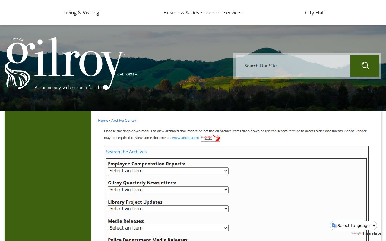
An archive hit can corroborate a meeting, project, release, or civic role at a date. It is not an index of everyone on a Gilroy street. Keep the category and date beside the result.
Gilroy Street Names, ZIPs, and Boundaries
Gilroy's verified city-name ZIP is 95020, but the postal area extends into rural land in southern Santa Clara County. USPS is the first check: enter Gilroy and CA, or the full address for delivery verification. A ZIP is delivery geography, not an incorporated boundary, so a postal Gilroy address may lead to county records.
The Assessor has no ZIP field. SCCMap supplies parcel and city-limit context, while the Registrar guide accepts street components and ZIP for election geography. The Census ZCTA for 95020 is a statistical approximation, not a route or resident list. Parcel counts cannot become a ZIP household count.
Near an edge, save normalized situs, APN, legal description, and USPS ZIP. If one differs, explain it rather than silently changing the address. That distinction keeps a Gilroy street directory search tied to the right custodian.
Gilroy Street Directory Voter Limits
A street name cannot be entered into California's voter-status form to retrieve a household list. My Voter Status asks for name, birthdate, and an identification fragment so one person can see registration, party, polling place, vote-by-mail status, and election information. The Registrar guide can use address and ZIP for precinct context, not names.
Elections Code §2194 keeps voter registration information confidential except for qualifying purposes. Commercial use and harassment are prohibited, and protected voters receive extra shielding. The Registrar's office at 1555 Berger Drive, Building 2, San Jose, accepts signed corrections by email, mail, or fax. Authorized file requests go through the Registrar or SOS. Ordinary street research stops at geography.
Myth. A voter lookup is not a public resident finder. A successful self-check confirms the account holder's record. A failed self-check does not prove that the person is not registered, and no lawful result should be reverse-engineered into a Gilroy street roster.
Reverse Directories for Old Gilroy Streets
Current ownership and historical occupancy are different layers. Gilroy Library has newspapers, fire-insurance maps, local books, and yearbooks. Gilroy Advocate runs 1868 to 1922 at home; Gilroy Evening Dispatch 1925 to 1943 in-library; Gilroy Dispatch 1944 to 1999 and 2001 to 2004 in-library. Ask staff for an address, obituary, or surname search.
Reverse or criss-cross directories arrange entries by street, address, or telephone number. They place a householder for a time, while deeds name title parties and census schedules enumerate a household for one year. Pair each with APN and legal description. Confirm exact Gilroy titles and years in the library or California Room catalog. The historical collections are treated on the Gilroy city directories page.
Clean Gilroy Address Chain
For an important address, preserve the sequence. Record situs and search date. Save the APN and assessor map. Note adjacent and air-parcel relationships in SCCMap. At the Recorder, write instrument number, recording date, grantor, grantee, and legal description. A grantor conveys an interest. A grantee receives it. A chain of title links those instruments over time.
Definition box. A parcel is the mapped assessment unit. A situs address is the physical property location. A plat is a recorded subdivision map. A criss-cross directory is an address-organized publication. None of those terms means every person connected to the property.
Santa Clara's public Official Records Index was removed from the web in 2018, but in-office records reach 1850. Plan for the main office, in-person name searching, and copies in person or by mail. Older books may need a counter or predecessor index. No single channel replaces the others.
Insider tip. Bring variant names, an APN, the legal description, and a date bracket to the Recorder counter. Those clues are stronger than an address alone.
Limits of a Gilroy Street Directory
A Gilroy street directory can connect parcels, instruments, permits, election geography, and dated listings. It cannot reveal every person at an address. Household members are not indexed by the Assessor. DMV addresses are restricted by the federal Driver's Privacy Protection Act. Utility and delivery lists are not public-directory shortcuts. Homeowners' exemption claims are not public, so there is no lawful homestead list.
GIS adjacency is also narrower than it looks. A neighboring polygon shows geometry and an APN, not an occupant. Air parcels can represent condominium interests without a conventional land polygon. A deed shows named title parties on a document date. A reverse directory shows a listed householder in a publication year. Each result needs its own label and time frame.
Lawful personal use. Use address records for house history, family research, civic curiosity, and personal safety. California Penal Code §§646.9 and 653.2 address stalking and harmful distribution of identifying information. Do not use Gilroy address research to stalk, harass, threaten, intimidate, or harm anyone, and do not try to expose protected voters or Safe at Home participants.